
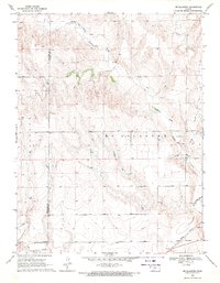
1969 Map of Mc Allaster SE
USGS Topo · Published 1971About this map
The North Fork Smoky Hill River carves a distinct path through the southern half of this western Kansas landscape, accompanied by a small Gaging Station that monitored the prairie water levels in the late 1960s. The transport corridor is defined by the Union Pacific railroad, which runs parallel to the river and established the region's primary shipping link. Evidence of local industry and infrastructure is visible in the scattered Sandpits and a lone Lowe Landing Strip in the eastern section. This survey captures the transition between the rolling high plains and the more eroded breaks of the river valley, where drainage features like Sand Cr feed into the primary waterway within the Winona and Mc Allaster townships.
Find a feature on this map
10 named features on this map. Tap any name to fly to it.
Don’t see what you’re looking for? This feature index may not catch every label — zoom into the map to look around manually.
Map Details
Editions of this 1969 Mc Allaster SE Map
This is the sole edition of this map. No revisions or reprints were ever made.
Other maps of this area

1954 · Goodland
USGS Topo · 1:250,000

1955 · Scott City
USGS Topo · 1:250,000

1956 · Goodland
USGS Topo · 1:250,000

1957 · Goodland
USGS Topo · 1:250,000

1958 · Scott City
USGS Topo · 1:250,000

1969 · Mc Allaster NW
USGS Topo · 1:24,000

1969 · Russell Springs 2 NW
USGS Topo · 1:24,000

1969 · Russell Springs 2 NE
USGS Topo · 1:24,000

1969 · Mc Allaster NE
USGS Topo · 1:24,000
1969 · Mc Allaster
USGS Topo · 1:24,000