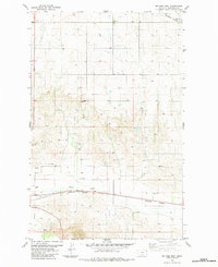
1983 Map of Mc Cabe West
USGS Topo · Published 1984About this map
Mc Cabe sits at the northeastern corner of this Roosevelt County landscape, where the high plains meet a network of essential infrastructure. The southern portion of the sheet is defined by the Burlington Northern railroad, which parallels Clover Creek and connects the industrial footprint of the Substa with the broader region. This late-1970s terrain is marked by the systematic extraction of resources, evidenced by several Gravel Pit and Gravel Pits sites located west of the main drainage.
Find a feature on this map
16 named features on this map. Tap any name to fly to it.
Don’t see what you’re looking for? This feature index may not catch every label — zoom into the map to look around manually.
Map Details
Editions of this 1983 Mc Cabe West Map
This is the sole edition of this map. No revisions or reprints were ever made.
Other maps of this area

1914 · Homestead
USGS Topo · 1:62,500

1949 · Johnson Lake
USGS Topo · 1:24,000
1950 · Johnson Lake
USGS Topo · 1:24,000

1954 · Wolf Point
USGS Topo · 1:250,000

1958 · Wolf Point
USGS Topo · 1:250,000

1969 · Cedar Coulee
USGS Topo · 1:24,000
1969 · Culbertson
USGS Topo · 1:24,000

1969 · Three Buttes
USGS Topo · 1:24,000

1969 · Dugout Creek
USGS Topo · 1:24,000

1982 · Culbertson
USGS Topo · 1:100,000