1969 Map of Cedar Coulee
USGS Topo · Published 1973About this map
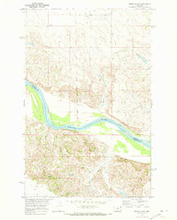
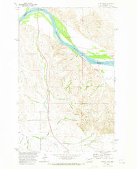
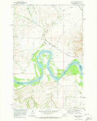
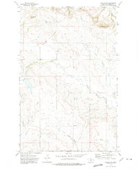
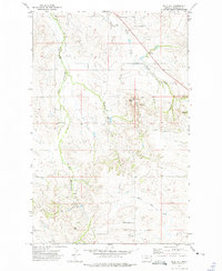
The Missouri River cuts through the center of this landscape, forming the natural border between Roosevelt and Richland counties. This late 1960s survey documents a rugged riverbank environment marked by deep drainages such as Star Coulee, Deep Coulee, and Cedar Coulee. One of the most historically significant features is the Old Fort Buford Military Reservation Boundary, which indicates the lasting administrative footprint of the frontier military era on the local land divisions. Evidence of small-scale resource extraction appears south of the river at Three Mine and near Coal Mine Coulee, where the terrain becomes increasingly complex. Transportation across these breaks is limited, often relying on a Jeep Trail winding through the uplands. Near the riverbanks, landmarks like Otis and Rocky Point serve as orientation points in this sparsely populated stretch of the Missouri River Basin.
Find a feature on this map
14 named features on this map. Tap any name to fly to it.
Don’t see what you’re looking for? This feature index may not catch every label — zoom into the map to look around manually.
Map Details
Editions of this 1969 Cedar Coulee Map
2 editions found

Other maps of this area

1909 · Glendive
USGS Topo · 1:250,000

1954 · Glendive
USGS Topo · 1:250,000

1954 · Wolf Point
USGS Topo · 1:250,000

1957 · Glendive
USGS Topo · 1:250,000

1958 · Wolf Point
USGS Topo · 1:250,000

1958 · Glendive
USGS Topo · 1:250,000
1969 · Three Buttes
USGS Topo · 1:24,000
1969 · Bainville SW
USGS Topo · 1:24,000
1972 · Fairview NW
USGS Topo · 1:24,000
1972 · Blue Hill
USGS Topo · 1:24,000