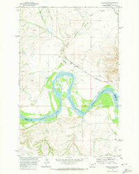
1969 Map of Bainville SW
USGS Topo · Published 1973About this map
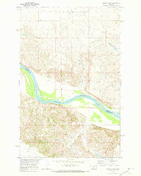
The Missouri River forms a wide, meandering boundary across this landscape, dividing the borderlands of Roosevelt and Richland counties. In the late 1960s, this region was characterized by the convergence of major transportation and natural features, including the Burlington Northern railroad corridor and the Bainville Road. Small rural clusters such as Lanark and Lakeside are situated near the waterways, while the Nohly Cem serves as a significant genealogical marker for the local community near the river's southern banks.
Find a feature on this map
14 named features on this map. Tap any name to fly to it.
Don’t see what you’re looking for? This feature index may not catch every label — zoom into the map to look around manually.
Map Details
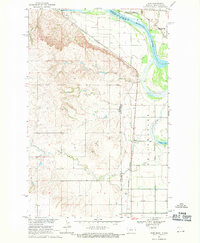
Editions of this 1969 Bainville SW Map
2 editions found

Other maps of this area

1909 · Glendive
USGS Topo · 1:250,000

1954 · Glendive
USGS Topo · 1:250,000

1954 · Wolf Point
USGS Topo · 1:250,000

1957 · Glendive
USGS Topo · 1:250,000

1958 · Wolf Point
USGS Topo · 1:250,000

1958 · Glendive
USGS Topo · 1:250,000
1968 · Dore
USGS Topo · 1:24,000

1968 · Bainville SE
USGS Topo · 1:24,000
1969 · Cedar Coulee
USGS Topo · 1:24,000
1972 · Fairview NW
USGS Topo · 1:24,000