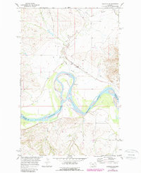
1969 Map of Bainville SW
USGS Topo · Published 1989About this map
The Missouri River defines the southern portion of this landscape, winding through the borderlands of Roosevelt Co and Richland Co. This 1969 survey, later updated with photorevisions, reveals a sparsely populated agricultural and ranching region where the Burlington Northern railroad serves as the primary artery for movement through the northern section. The settlement pattern is largely focused around small hubs like Lanark and Lakeside, which sit along the rail line and the South Bainville Road.
Find a feature on this map
15 named features on this map. Tap any name to fly to it.
Don’t see what you’re looking for? This feature index may not catch every label — zoom into the map to look around manually.
Map Details
Editions of this 1969 Bainville SW Map
2 editions found
Other maps of this area

1909 · Glendive
USGS Topo · 1:250,000

1954 · Glendive
USGS Topo · 1:250,000

1954 · Wolf Point
USGS Topo · 1:250,000

1957 · Glendive
USGS Topo · 1:250,000

1958 · Wolf Point
USGS Topo · 1:250,000

1958 · Glendive
USGS Topo · 1:250,000
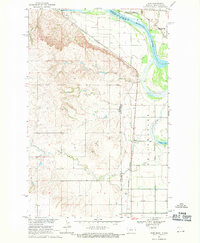
1968 · Dore
USGS Topo · 1:24,000

1968 · Bainville SE
USGS Topo · 1:24,000

1969 · Cedar Coulee
USGS Topo · 1:24,000

1969 · Bainville SW
USGS Topo · 1:24,000