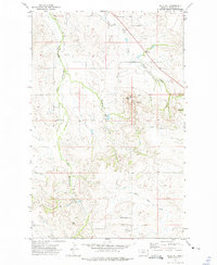
1972 Map of Blue Hill
USGS Topo · Published 1975About this map
The high plains of eastern Montana are defined by the winding drainages of East Hardscrabble Creek and Main Hay Creek in this early 1970s landscape. Settlement patterns are sparse, anchored by local institutions like Doran School and the Cherry Creek Ch, which sits near its namesake Cherry Creek Sch. The terrain is marked by prominent rises such as Blue Hill and Lone Butte, the latter of which features the isolated Lone Butte Cem.
Find a feature on this map
16 named features on this map. Tap any name to fly to it.
Don’t see what you’re looking for? This feature index may not catch every label — zoom into the map to look around manually.
Map Details
Editions of this 1972 Blue Hill Map
This is the sole edition of this map. No revisions or reprints were ever made.
Other maps of this area

1909 · Glendive
USGS Topo · 1:250,000

1954 · Glendive
USGS Topo · 1:250,000

1954 · Wolf Point
USGS Topo · 1:250,000

1957 · Glendive
USGS Topo · 1:250,000

1958 · Wolf Point
USGS Topo · 1:250,000

1958 · Glendive
USGS Topo · 1:250,000

1969 · Cedar Coulee
USGS Topo · 1:24,000

1969 · Three Buttes
USGS Topo · 1:24,000

1969 · Dugout Creek
USGS Topo · 1:24,000

1972 · Brorson
USGS Topo · 1:24,000