
1969 Map of Three Buttes
USGS Topo · Published 1973About this map
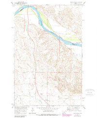
The Missouri River cuts a wide, curving path along the northern edge of this landscape, marking the boundary between Roosevelt and Richland Counties. The terrain is defined by an intricate network of drainage systems, including Day Creek, Elm Coulee, and the aptly named Hardscrabble Creek, which carve into the high ground south of the river. A Gaging Sta sits near the riverbank, documenting the hydrology of the Missouri River Basin during a period of active regional water resource development.
Find a feature on this map
16 named features on this map. Tap any name to fly to it.
Don’t see what you’re looking for? This feature index may not catch every label — zoom into the map to look around manually.
Map Details
Editions of this 1969 Three Buttes Map
2 editions found
Other maps of this area

1909 · Glendive
USGS Topo · 1:250,000

1954 · Glendive
USGS Topo · 1:250,000

1954 · Wolf Point
USGS Topo · 1:250,000

1957 · Glendive
USGS Topo · 1:250,000

1958 · Wolf Point
USGS Topo · 1:250,000

1958 · Glendive
USGS Topo · 1:250,000

1969 · Cedar Coulee
USGS Topo · 1:24,000
1969 · Culbertson
USGS Topo · 1:24,000

1969 · Dugout Creek
USGS Topo · 1:24,000
1972 · Blue Hill
USGS Topo · 1:24,000