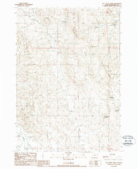
1988 Map of Mc Carthy Ridge
USGS Topo · Published 1988About this map
Mc Carthy Ridge dominates this high-desert landscape in Malheur County, where water management is the primary evidence of human activity. The 1988 provisional survey reveals a complex network of springs and reservoirs critical for ranching and survival in this arid environment. To the south, Tub Mountain rises as a prominent landmark, flanked by its namesake Tub Mountain Reservoir and the West Tub Mtn Reservoir.
Find a feature on this map
23 named features on this map. Tap any name to fly to it.
Don’t see what you’re looking for? This feature index may not catch every label — zoom into the map to look around manually.
Map Details
Editions of this 1988 Mc Carthy Ridge Map
This is the sole edition of this map. No revisions or reprints were ever made.
Other maps of this area

1950 · Jamieson
USGS Topo · 1:62,500

1951 · Moores Hollow
USGS Topo · 1:62,500

1951 · Huntington
USGS Topo · 1:62,500

1952 · Olds Ferry
USGS Topo · 1:24,000

1952 · Olds Ferry
USGS Topo · 1:62,500

1955 · Baker
USGS Topo · 1:250,000

1959 · Baker
USGS Topo · 1:250,000

1980 · Brogan
USGS Topo · 1:100,000
1987 · Willowcreek
USGS Topo · 1:24,000
1988 · Birch Creek Meadow
USGS Topo · 1:24,000