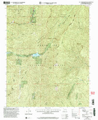
2002 Map of Mc Clure Reservoir
USGS Topo · Published 2003About this map
The Municipal Watershed protected area dominates this landscape east of Santa Fe, serving as a critical resource for the region's water supply. Centered on the McClure Reservoir and Nichols Reservoir along the Santa Fe River, the map captures a high-elevation terrain where land grants like the Juan De Gabaldon Grant and Santiago Grant meet the boundaries of the Santa Fe National Forest.
Find a feature on this map
40 named features on this map. Tap any name to fly to it.
Don’t see what you’re looking for? This feature index may not catch every label — zoom into the map to look around manually.
Map Details
Editions of this 2002 Mc Clure Reservoir Map
This is the sole edition of this map. No revisions or reprints were ever made.
Other maps of this area

1889 · Santa Fe
USGS Topo · 1:125,000

1894 · Santa Fe
USGS Topo · 1:125,000

1952 · Santa Fe
USGS Topo · 1:24,000

1952 · Seton Village
USGS Topo · 1:24,000

1953 · Tesuque
USGS Topo · 1:24,000

1953 · Glorieta
USGS Topo · 1:24,000

1953 · Mc Clure Reservoir
USGS Topo · 1:24,000

1953 · Aspen Basin
USGS Topo · 1:24,000

1954 · Santa Fe
USGS Topo · 1:250,000

1958 · Santa Fe
USGS Topo · 1:250,000