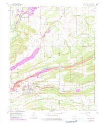
1968 Map of Mc Curtain
USGS Topo · Published 1983About this map
McCurtain sits at the base of Diamond Mountain, serving as a central hub in a landscape defined by significant resource extraction and shifting industrial infrastructure. This 1968 survey, updated with 1980 photogrammetric data, highlights an extensive network of strip mines and reclaimed areas that dominate the terrain between Sans Bois Mountain and Campground Spring Mountain. The presence of the Old Railroad Grade and labels for the Fort Smith and Van Buren line suggest a transition from rail-dependent coal transport to other methods, while the northern edge is marked by the expansive Robert S Kerr Reservoir. Local genealogy is anchored by landmarks like the Garden of Memories Cem, Center Point Ch, and the small settlement of Ironbridge. Natural drainage is carved by numerous waterways including Sans Bois Creek and Wildhorse Creek, which flow through the undulating topography of the Haskell and Le Flore county line.
Find a feature on this map
27 named features on this map. Tap any name to fly to it.
Don’t see what you’re looking for? This feature index may not catch every label — zoom into the map to look around manually.
Map Details
Editions of this 1968 Mc Curtain Map
2 editions found
Other maps of this area

1900 · Sansbois
USGS Topo · 1:125,000

1900 · Sallisaw
USGS Topo · 1:125,000

1909 · Sans Bois
USGS Topo · 1:125,000

1911 · Sallisaw
USGS Topo · 1:125,000

1911 · Sansbois
USGS Topo · 1:125,000

1946 · Fort Smith
USGS Topo · 1:250,000

1962 · Stigler East
USGS Topo · 1:24,000

1965 · Fort Smith
USGS Topo · 1:250,000

1967 · Fort Smith
USGS Topo · 1:250,000
1967 · Keota
USGS Topo · 1:24,000