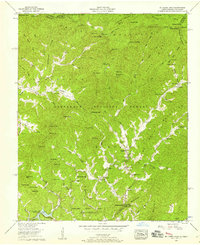
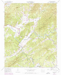
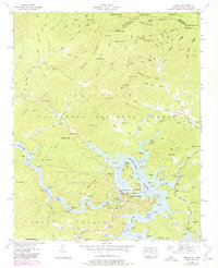
1957 Map of Mc Daniel Bald
USGS Topo · Published 1958This historical map portrays the area of Mc Daniel Bald in 1957, primarily covering Cherokee County Community as well as portions of Tennessee. Featuring a scale of 1:24000, this map provides a highly detailed snapshot of the terrain, roads, buildings, counties, and historical landmarks in the Mc Daniel Bald region at the time. Published in 1958, it is one of 3 known editions of this map due to revisions or reprints.
Find a feature on this map
100 named features on this map. Tap any name to fly to it.
Don’t see what you’re looking for? This feature index may not catch every label — zoom into the map to look around manually.
Map Details
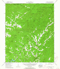
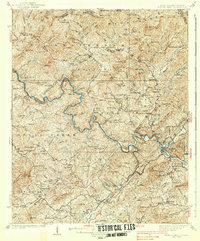
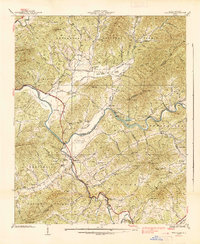
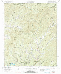
Editions of this 1957 Mc Daniel Bald Map
3 editions found
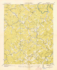
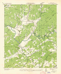
Historical Maps of Ebenezer Through Time
12 maps found

1934 McDaniel Bald
Cherokee County, NC
1934 Persimmon Creek
Cherokee County, NC

1934 Unaka
Cherokee County, NC
1935 Peachtree
Cherokee County, NC
1937 Peachtree
Cherokee County, NC
1938 Fowler Bend
Cherokee County, NC
1938 Peachtree
Cherokee County, NC
1957 Mc Daniel Bald
Cherokee County, NC

1957 Persimmon Creek
Cherokee County, NC
1957 Unaka
Cherokee County, NC

1971 Blacksburg North
Cherokee County, NC
1988 Culberson
Cherokee County, NC