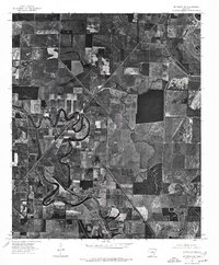
1975 Map of Mc Gehee NE
USGS Topo · Published 1976About this map
The community of Mc Arthur sits along the winding path of Bayou Macon in this 1970s orthophotographic study. Unlike traditional topographic maps, this aerial perspective reveals the precise textures of the Arkansas Delta's agricultural landscape, where geometric field patterns are interrupted by the sinuous curves of natural waterways. The southern flow of Boggy creek segments the eastern portion of the terrain, illustrating the complex drainage of Desha County's bottomlands. This specific record provides a clear view of the rural intersection between cultivated land and the riparian corridors that historically dictated settlement patterns in this part of the state, as seen in the clustered structures near the bayou's oxbows.
Find a feature on this map
4 named features on this map. Tap any name to fly to it.
Don’t see what you’re looking for? This feature index may not catch every label — zoom into the map to look around manually.
Map Details
Editions of this 1975 Mc Gehee NE Map
This is the sole edition of this map. No revisions or reprints were ever made.
Other maps of this area

1933 · Lamont
USGS Topo · 1:62,500

1935 · Red Fork
USGS Topo · 1:62,500

1936 · McGehee
USGS Topo · 1:62,500

1937 · McGehee
USGS Topo · 1:62,500

1939 · Big Island
USGS Topo · 1:62,500

1939 · Lamont
USGS Topo · 1:62,500

1953 · Greenwood
USGS Topo · 1:250,000

1955 · McGehee
USGS Topo · 1:62,500

1956 · Greenwood
USGS Topo · 1:250,000
1969 · Winchester
USGS Topo · 1:24,000