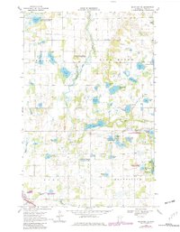
1969 Map of Mc Intosh NE
USGS Topo · Published 1982About this map
Hill River meanders through the central landscape of this Minnesota quadrangle, which is defined by an extensive network of marshes, sloughs, and family-named lakes. During the late 1960s, this region was undergoing significant conservation efforts, as evidenced by the large tracts of land designated as the Enerson State Wildlife Management Area and the National Wildlife Management Area. These protected zones surround prominent water bodies such as Enerson Lake and Olson Lake, preserving the wetlands that characterize the townships of Lessor, Hill River, and Brands Vold.
Find a feature on this map
51 named features on this map. Tap any name to fly to it.
Don’t see what you’re looking for? This feature index may not catch every label — zoom into the map to look around manually.
Map Details
Editions of this 1969 Mc Intosh NE Map
2 editions found
Other maps of this area

1919 · Fosston
USGS Topo · 1:62,500

1919 · Grit
USGS Topo · 1:62,500

1919 · Winsor
USGS Topo · 1:62,500

1954 · Bemidji
USGS Topo · 1:250,000

1957 · Bemidji
USGS Topo · 1:250,000

1958 · Bemidji
USGS Topo · 1:250,000

1969 · Olga
USGS Topo · 1:24,000

1969 · Mc Intosh NE
USGS Topo · 1:24,000

1969 · Fosston East
USGS Topo · 1:24,000
1969 · Mc Intosh
USGS Topo · 1:24,000