
1955 Map of Mc Intosh Ranch
USGS Topo · Published 1956About this map
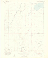
Mc Intosh Ranch and the isolated Spady Cow Camp anchor this mid-century look at the hydraulic landscape of Bent County. The area is defined by a sophisticated system of water management, centered on the Adobe Creek Reservoir and the Fort Lyon Storage Canal. The map reveals the intricate network of irrigation and water transport required for high-plains agriculture, including the Lewis Ranch Ditch and the Horse Creek Inlet. Evidence of changing land use is visible at the Landing Field (Aband) near the Fort Lyon Canal Road. This survey, compiled from 1947 aerial photography and 1955 field work, provides a precise record of the engineering structures like the Horse Creek Reservoir Dam (Lewis Ranch) and various spillways that dictated the economy and settlement patterns of this arid Colorado terrain.
Find a feature on this map
22 named features on this map. Tap any name to fly to it.
Don’t see what you’re looking for? This feature index may not catch every label — zoom into the map to look around manually.
Map Details
Editions of this 1955 Mc Intosh Ranch Map
2 editions found
Other maps of this area

1891 · Las Animas
USGS Topo · 1:125,000

1893 · Las Animas
USGS Topo · 1:125,000

1953 · Las Animas
USGS Topo · 1:24,000

1953 · Cornelia
USGS Topo · 1:24,000

1953 · Hadley
USGS Topo · 1:24,000

1954 · Lamar
USGS Topo · 1:250,000

1955 · Bishop Ranch
USGS Topo · 1:24,000
1955 · Lewis Ranch
USGS Topo · 1:24,000

1958 · Lamar
USGS Topo · 1:250,000
1978 · Long Lake
USGS Topo · 1:24,000