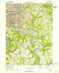
1953 Map of Mc Keesport
USGS Topo · Published 1955About this map
The industrial confluence of the Monongahela River and Youghiogheny River anchors this mid-century look at the Mon Valley. Heavy rail infrastructure, including the Pittsburgh and Lake Erie and Baltimore and Ohio, follows the riverbanks to serve the massive production centers of Mc Keesport, Duquesne, and Clairton. While the riverfronts are dominated by dense urban settlements and industrial works, the interior hills of White Oak and North Huntingdon reveal a landscape in transition, where postwar recreation sites like Rainbow Gardens Swimming Pool and a Miniature Railroad sit near active strip mines and the Hubbard Mine Shaft No 3. Genealogists will find a high density of named institutions, from the Boys Home in the city to numerous parochial cemeteries like Holy Family Cem and St Nicholas Cemetery.
Find a feature on this map
119 named features on this map. Tap any name to fly to it.
Don’t see what you’re looking for? This feature index may not catch every label — zoom into the map to look around manually.
Map Details
Editions of this 1953 Mc Keesport Map
This is the sole edition of this map. No revisions or reprints were ever made.
Other maps of this area

1902 · Brownsville
USGS Topo · 1:62,500

1902 · Connellsville
USGS Topo · 1:62,500

1904 · Mc Keesport
USGS Topo · 1:62,500

1904 · Greensburg
USGS Topo · 1:62,500

1906 · Brownsville
USGS Topo · 1:62,500

1906 · Greensburg
USGS Topo · 1:62,500

1907 · Pittsburg
USGS Topo · 1:62,500

1931 · Brownsville
USGS Topo · 1:62,500

1931 · Connellsville
USGS Topo · 1:62,500

1933 · Brownsville
USGS Topo · 1:62,500