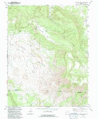
1994 Map of Mc Kenna Peak
USGS Topo · Published 1994About this map
McKenna Peak anchors the high ground of this southwestern Colorado landscape, overlooking the expansive Spring Creek Basin. This 1994 survey, based on aerial revisions from the late 1980s, documents a remote high-desert environment where ranching history and natural geography intersect. Family names are etched into the terrain at sites like the Bassnet Homestead and Heldman Homestead, providing tangible markers for genealogists and local historians tracing early settlement patterns in the Dry Creek Basin area. The presence of the Desert Claim and various gas wells reflects the ongoing intersection of land use and resource extraction. Water remains the critical factor here, evidenced by the intricate drainage systems of Dead Pony Horse Draw and Cocklebur Draw, which lead toward the southern boundary along Disappointment Creek.
Find a feature on this map
35 named features on this map. Tap any name to fly to it.
Don’t see what you’re looking for? This feature index may not catch every label — zoom into the map to look around manually.
Map Details
Editions of this 1994 Mc Kenna Peak Map
This is the sole edition of this map. No revisions or reprints were ever made.
Other maps of this area

1916 · Paradox Valley
USGS Topo · 1:125,000

1922 · Paradox Valley
USGS Topo · 1:125,000

1948 · Gypsum Gap
USGS Topo · 1:24,000

1949 · Gypsum Gap
USGS Topo · 1:24,000

1956 · Cortez
USGS Topo · 1:250,000

1956 · Moab
USGS Topo · 1:250,000

1958 · Cortez
USGS Topo · 1:250,000

1959 · Cortez
USGS Topo · 1:250,000

1959 · Moab
USGS Topo · 1:250,000

1960 · Moab
USGS Topo · 1:250,000