
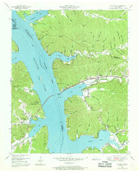
1950 Map of Mc Kinnon
USGS Topo · Published 1954About this map
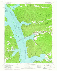
The Tennessee River corridor in Houston and Stewart Counties is dominated here by the expansive waters of Kentucky Lake, following the 1940s inundation. The topography is defined by dozens of narrow, family-named hollows like Sykes Hollow and Askew Hollow that reach toward the rising reservoir waters. The settlement of McKinnon serves as a local hub along the Louisville and Nashville railroad, which tracks parallel to Cane Creek before crossing the lake via a prominent bridge. Local genealogy is deeply rooted in the landscape, evidenced by numerous small burial grounds such as Mathis Cem, Wynns Cem, and the Nut Orchard Cem near the mouth of Whiteoak Creek. The map also captures an abandoned dock near the main channel and the Whiteoak Boat Dock to the south, reflecting the shift from river-based transport to recreational and conservation uses within the Tennessee National Migratory Wildlife Refuge.
Find a feature on this map
85 named features on this map. Tap any name to fly to it.
Don’t see what you’re looking for? This feature index may not catch every label — zoom into the map to look around manually.
Map Details
Editions of this 1950 Mc Kinnon Map
3 editions found
Other maps of this area

1936 · Poplar Creek
USGS Topo · 1:24,000

1936 · McKinnon
USGS Topo · 1:24,000

1936 · Big Sandy
USGS Topo · 1:24,000

1936 · Stewart
USGS Topo · 1:24,000

1936 · Centerville Landing
USGS Topo · 1:24,000

1936 · Halls Creek
USGS Topo · 1:24,000

1936 · Harmon Creek
USGS Topo · 1:24,000

1936 · Standing Rock
USGS Topo · 1:24,000

1936 · Dover
USGS Topo · 1:24,000

1949 · Harmon Creek
USGS Topo · 1:24,000