
1972 Map of Mc Kinnsey Reservoir West
USGS Topo · Published 1975About this map
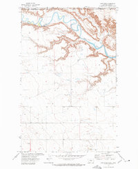
The northern Montana high plains in Hill County are defined here by a series of coulees and rural infrastructure essential to the mid-20th-century dryland farming community. Rudyard Road serves as a primary north-south artery, connecting widely dispersed homesteads and landmarks like Goldstone Ch and the Oreana Sch. The landscape is etched by the drainage patterns of Sage Creek and Little Sage Creek, which wind through the township sections toward the eastern edge of the map where Mc Kinnsey Res sits near Black Butte. This 1972 field-checked survey reveals the functional layout of the prairie, where clusters of Storage Bins are strategically positioned near Grace Ch to support the grain economy of the Big Sky country.
Find a feature on this map
13 named features on this map. Tap any name to fly to it.
Don’t see what you’re looking for? This feature index may not catch every label — zoom into the map to look around manually.
Map Details
Editions of this 1972 Mc Kinnsey Reservoir West Map
This is the sole edition of this map. No revisions or reprints were ever made.
Other maps of this area

1919 · Alma
USGS Topo · 1:125,000

1920 · Gildford
USGS Topo · 1:125,000

1943 · Gildford
USGS Topo · 1:125,000

1954 · Shelby
USGS Topo · 1:250,000

1958 · Shelby
USGS Topo · 1:250,000

1969 · Gildford NW
USGS Topo · 1:24,000

1972 · Goldstone SW
USGS Topo · 1:24,000

1972 · Rudyard NW
USGS Topo · 1:24,000

1972 · Mc Kinnsey Reservoir East
USGS Topo · 1:24,000
1972 · Lost River
USGS Topo · 1:24,000