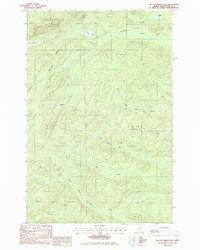
1985 Map of Mc Lean Mtn
USGS Topo · Published 1986About this map
McLean Mountain dominates this northern Maine landscape, a wilderness area defined by the headwaters of numerous streams and rivers in the mid-1980s. The terrain transitions from the high peaks of the St Francis boundary toward the water-rich lands of St John Plantation. A network of logging roads and trails threads through the townships, including T 16 R 9 Wels and T 16 R 8 Wels, reflecting the area's timber-driven history.
Find a feature on this map
19 named features on this map. Tap any name to fly to it.
Don’t see what you’re looking for? This feature index may not catch every label — zoom into the map to look around manually.
Map Details
Editions of this 1985 Mc Lean Mtn Map
This is the sole edition of this map. No revisions or reprints were ever made.
Other maps of this area

1928 · Eagle Lake
USGS Topo · 1:48,000

1928 · Winterville
USGS Topo · 1:48,000

1930 · St Francis
USGS Topo · 1:48,000

1931 · Fish River Lake
USGS Topo · 1:48,000

1931 · Eagle Lake
USGS Topo · 1:62,500

1931 · Winterville
USGS Topo · 1:62,500

1933 · St Francis
USGS Topo · 1:62,500

1935 · Fish River Lake
USGS Topo · 1:62,500

1954 · Presque Isle
USGS Topo · 1:250,000

1958 · Presque Isle
USGS Topo · 1:250,000