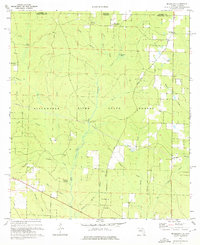
1973 Map of Mc Lellan
USGS Topo · Published 1976About this map
The Blackwater River State Forest dominates this landscape along the Florida-Alabama border, where the convergence of Coldwater Creek and the Big Fork creates a complex network of wetlands and tributaries. The timber and transit history of the region is evident in the Old Railroad Grade and numerous tracks like Three Notch that wind through the pine woods. Small rural communities are anchored by local landmarks such as McLellan Ch and the isolated Sellersville Cem.
Find a feature on this map
44 named features on this map. Tap any name to fly to it.
Don’t see what you’re looking for? This feature index may not catch every label — zoom into the map to look around manually.
Map Details
Editions of this 1973 Mc Lellan Map
2 editions found
Other maps of this area

1943 · Jay
USGS Topo · 1:62,500

1948 · Munson
USGS Topo · 1:62,500

1950 · Munson
USGS Topo · 1:62,500

1953 · Andalusia
USGS Topo · 1:250,000

1957 · Andalusia
USGS Topo · 1:250,000

1957 · Pensacola
USGS Topo · 1:250,000

1959 · Pensacola
USGS Topo · 1:250,000

1959 · Brewton South
USGS Topo · 1:24,000

1960 · Pensacola
USGS Topo · 1:250,000

1960 · Brewton South
USGS Topo · 1:24,000