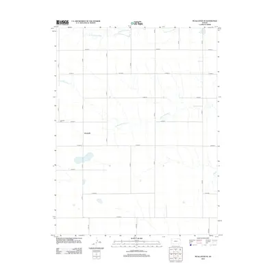
2012 Map of McAllaster NE
USGS Topo · Published 2012About this map
Brownville anchors this High Plains landscape, a remote settlement in Thomas County where the local social geography is centered around the Brownville Cemetery. The terrain is defined by the headwaters of two significant drainage systems, with the South Fork Solomon River cutting across the northern reaches and the South Fork Saline River meandering through the central and southern portions of the quadrangle. This 2012 survey illustrates the classic section-line road grid typical of the Kansas prairie, with a network of designated routes such as County Road A through County Road H facilitating movement across the vast agricultural blocks. The presence of several small water catchments and the braided patterns of the dry creek beds suggest the seasonal nature of water in this semi-arid region.
Find a feature on this map
22 named features on this map. Tap any name to fly to it.
Don’t see what you’re looking for? This feature index may not catch every label — zoom into the map to look around manually.
Map Details
Editions of this 2012 McAllaster NE Map
This is the sole edition of this map. No revisions or reprints were ever made.
Other maps of this area

1943 · Colby
USGS Topo · 1:62,500

1954 · Goodland
USGS Topo · 1:250,000

1956 · Goodland
USGS Topo · 1:250,000

1957 · Goodland
USGS Topo · 1:250,000

1966 · Brewster
USGS Topo · 1:24,000

1966 · Brewster SE
USGS Topo · 1:24,000

1967 · Colby SW
USGS Topo · 1:24,000

1969 · Mc Allaster NW
USGS Topo · 1:24,000

1969 · Mc Allaster SE
USGS Topo · 1:24,000

1969 · Mc Allaster NE
USGS Topo · 1:24,000