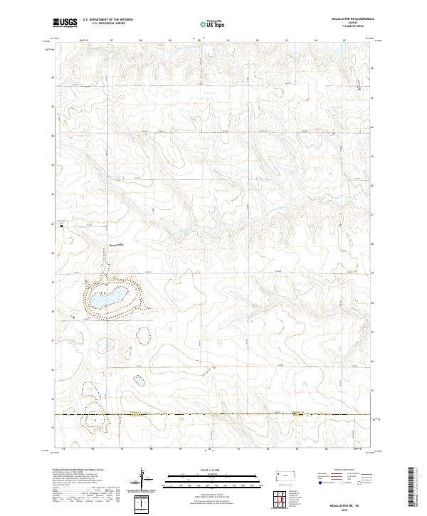
2022 Map of McAllaster NE
USGS Topo · Published 2022About this map
The S Fork Solomon River and S Fork Saline River cut through the high plains of western Kansas, revealing the subtle drainage patterns of the region. This 2022 survey captures the quiet rural landscape where the small settlement of Brownville serves as a local point of reference. Located near the Brownville Cem, this community sits amidst a strictly organized grid of county roads, such as Co RD 3 and Co RD E, which facilitate agricultural movement across the prairie. The map also delineates the jurisdictional boundary between Thomas Co and Logan Co, marking a transition in local governance. This modern topograhic study provides an accurate record of section lines and watercourses in a part of the state characterized by its expansive open terrain and deep-rooted farming heritage.
Find a feature on this map
30 named features on this map. Tap any name to fly to it.
Don’t see what you’re looking for? This feature index may not catch every label — zoom into the map to look around manually.
Map Details
Editions of this 2022 McAllaster NE Map
This is the sole edition of this map. No revisions or reprints were ever made.
Other maps of this area

1943 · Colby
USGS Topo · 1:62,500

1954 · Goodland
USGS Topo · 1:250,000

1956 · Goodland
USGS Topo · 1:250,000

1957 · Goodland
USGS Topo · 1:250,000

1966 · Brewster
USGS Topo · 1:24,000

1966 · Brewster SE
USGS Topo · 1:24,000

1967 · Colby SW
USGS Topo · 1:24,000

1969 · Mc Allaster NW
USGS Topo · 1:24,000

1969 · Mc Allaster SE
USGS Topo · 1:24,000

1969 · Mc Allaster NE
USGS Topo · 1:24,000