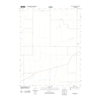
2009 Map of McAllaster SE
USGS Topo · Published 2009About this map
The North Fork Smoky Hill River meanders across the southern portion of this Logan County landscape, serving as a primary hydrologic landmark in a region defined by its wide open spacing and sparse settlement. In the early 21st century, the area remains characterized by large-scale agricultural divisions, with a network of section-line roads like Co Rd 190 and Co Rd 170 providing the primary transit framework. Several curiously named locations appear throughout the quadrangle, including Eagle Eye and Day Dream in the north, and Zest and Vista further south. The presence of the Lowe Landing Strip in the east suggests the importance of private aviation in managing these expansive plains. Local drainage is further defined by Sand Creek and the Middle Branch Hackberry Creek, which cut across the high plains terrain north of the river.
Find a feature on this map
14 named features on this map. Tap any name to fly to it.
Don’t see what you’re looking for? This feature index may not catch every label — zoom into the map to look around manually.
Map Details
Editions of this 2009 McAllaster SE Map
This is the sole edition of this map. No revisions or reprints were ever made.
Other maps of this area

1954 · Goodland
USGS Topo · 1:250,000

1955 · Scott City
USGS Topo · 1:250,000

1956 · Goodland
USGS Topo · 1:250,000

1957 · Goodland
USGS Topo · 1:250,000

1958 · Scott City
USGS Topo · 1:250,000

1969 · Mc Allaster NW
USGS Topo · 1:24,000

1969 · Russell Springs 2 NW
USGS Topo · 1:24,000

1969 · Mc Allaster SE
USGS Topo · 1:24,000

1969 · Russell Springs 2 NE
USGS Topo · 1:24,000

1969 · Mc Allaster NE
USGS Topo · 1:24,000