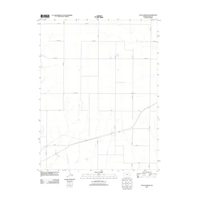
2012 Map of McAllaster SE
USGS Topo · Published 2012About this map
The N Fork Smoky Hill River carves through the southwestern corner of this Logan County landscape, providing a rare water source in the high plains of western Kansas. Unlike traditional township grids, this area features several uniquely named tracts and developments including Eagle Eye, Day Dream, and Cedar Crst, which are interspersed with local roads like Co RD-170 and Co RD-190. The drainage network is further defined by Sand Cr in the west and Middle Br Hackberry Cr in the northeast. Transportation is anchored by the corridor running through Zest, Wagon, and Vista, reflecting the modern infrastructure and rural land use patterns of the early 21st century. This survey documents the specific naming conventions and road alignments that define the agricultural and residential character of the region south of McAllaster.
Find a feature on this map
16 named features on this map. Tap any name to fly to it.
Don’t see what you’re looking for? This feature index may not catch every label — zoom into the map to look around manually.
Map Details
Editions of this 2012 McAllaster SE Map
This is the sole edition of this map. No revisions or reprints were ever made.
Other maps of this area

1954 · Goodland
USGS Topo · 1:250,000

1955 · Scott City
USGS Topo · 1:250,000

1956 · Goodland
USGS Topo · 1:250,000

1957 · Goodland
USGS Topo · 1:250,000

1958 · Scott City
USGS Topo · 1:250,000

1969 · Mc Allaster NW
USGS Topo · 1:24,000

1969 · Russell Springs 2 NW
USGS Topo · 1:24,000

1969 · Mc Allaster SE
USGS Topo · 1:24,000

1969 · Russell Springs 2 NE
USGS Topo · 1:24,000

1969 · Mc Allaster NE
USGS Topo · 1:24,000