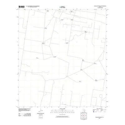
2010 Map of McAllen Ranch
USGS Topo · Published 2010About this map
The McAllen Ranch property and its surrounding ranchlands characterize this portion of Hidalgo County, defined by a sparse network of roads and essential water infrastructure. This semi-arid landscape is mapped through its reliance on windmills, which serve as the primary landmarks across the territory. Notable locations such as Los Indios Windmill, San Ignacio Windmill, and El Chorito Windmill indicate the vital importance of groundwater access for livestock and human habitation in South Texas.
Find a feature on this map
18 named features on this map. Tap any name to fly to it.
Don’t see what you’re looking for? This feature index may not catch every label — zoom into the map to look around manually.
Map Details
Editions of this 2010 McAllen Ranch Map
This is the sole edition of this map. No revisions or reprints were ever made.
Other maps of this area

1939 · Linn
USGS Topo · 1:62,500

1939 · La Reforma
USGS Topo · 1:62,500

1940 · Monte Christo
USGS Topo · 1:62,500

1949 · Mc Allen
USGS Topo · 1:250,000

1954 · McAllen
USGS Topo · 1:250,000

1957 · Mc Allen
USGS Topo · 1:250,000

1962 · McAllen
USGS Topo · 1:250,000

1963 · Monte Christo
USGS Topo · 1:24,000

1963 · Linn NW
USGS Topo · 1:24,000
1963 · Faysvillle
USGS Topo · 1:24,000