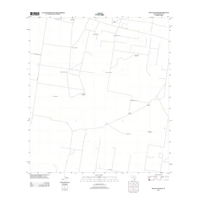
2012 Map of McAllen Ranch
USGS Topo · Published 2012About this map
McAllen Ranch serves as the namesake hub for this corner of Hidalgo County, where the landscape is defined by an extensive network of wind-driven water infrastructure. The map documents numerous individual water sources, such as El Nuevo Windmill, Los Indios Windmill, and El Progresso Windmill, which sustain the cattle-ranching operations in this arid region of South Texas. A singular place of local historical significance is the Guadalupe Toreros Cem, located near the northern boundary. The road system, including Guasolota Ranch Rd and FM-1017, connects these remote outposts. This survey illustrates the continued reliance on traditional water extraction methods to support the large-scale ranching economy that has long characterized this part of the Rio Grande Valley hinterlands.
Find a feature on this map
20 named features on this map. Tap any name to fly to it.
Don’t see what you’re looking for? This feature index may not catch every label — zoom into the map to look around manually.
Map Details
Editions of this 2012 McAllen Ranch Map
This is the sole edition of this map. No revisions or reprints were ever made.
Other maps of this area

1939 · Linn
USGS Topo · 1:62,500

1939 · La Reforma
USGS Topo · 1:62,500

1940 · Monte Christo
USGS Topo · 1:62,500

1949 · Mc Allen
USGS Topo · 1:250,000

1954 · McAllen
USGS Topo · 1:250,000

1957 · Mc Allen
USGS Topo · 1:250,000

1962 · McAllen
USGS Topo · 1:250,000

1963 · Monte Christo
USGS Topo · 1:24,000

1963 · Linn NW
USGS Topo · 1:24,000
1963 · Faysvillle
USGS Topo · 1:24,000