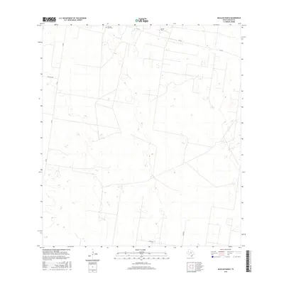
2016 Map of McAllen Ranch
USGS Topo · Published 2016About this map
McAllen Ranch and its surrounding rangelands characterize this portion of Hidalgo County, where large-scale landholdings are defined by a sparse network of ranch roads and rural highways. The map provides a detailed topographic view of the undulating terrain, punctuated by the Guadalupe Toreros Cem in the northern reaches. Infrastructure is primarily focused on transportation corridors such as Fm 1017 and Fm 681, which intersect near the ranch headquarters. Other named routes like Guajolota Rd, Kamien Rd, and Zimmer Rd trace the boundaries of these expansive Texas properties. This 2016 survey reflects the persistent cattle-ranching heritage of the Rio Grande Valley hinterlands, showing the location of small watering holes and topographic depressions across the landscape.
Find a feature on this map
7 named features on this map. Tap any name to fly to it.
Don’t see what you’re looking for? This feature index may not catch every label — zoom into the map to look around manually.
Map Details
Editions of this 2016 McAllen Ranch Map
This is the sole edition of this map. No revisions or reprints were ever made.
Other maps of this area

1939 · Linn
USGS Topo · 1:62,500

1939 · La Reforma
USGS Topo · 1:62,500

1940 · Monte Christo
USGS Topo · 1:62,500

1949 · Mc Allen
USGS Topo · 1:250,000

1954 · McAllen
USGS Topo · 1:250,000

1957 · Mc Allen
USGS Topo · 1:250,000

1962 · McAllen
USGS Topo · 1:250,000

1963 · Monte Christo
USGS Topo · 1:24,000

1963 · Linn NW
USGS Topo · 1:24,000
1963 · Faysvillle
USGS Topo · 1:24,000