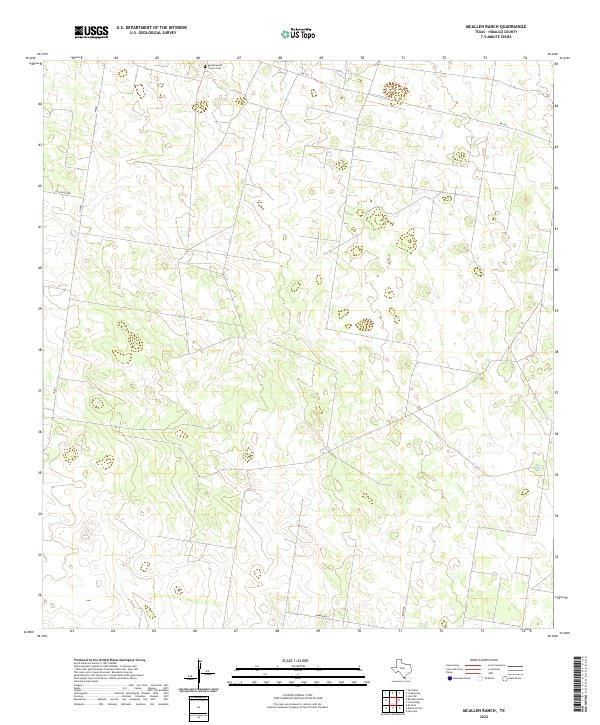
2022 Map of McAllen Ranch
USGS Topo · Published 2022About this map
Guadalupe El Torrero Cem sits near the northern boundary of this Hidalgo County landscape, marking a point of cultural and genealogical significance within a territory defined by large ranching tracts and sparse rural infrastructure. This 2022 survey captures the area's characteristic isolation, where the terrain is navigated primarily via farm-to-market roads and specialized ranch tracks. Modern connectivity is represented by FM 1017 and FM 681, while local thoroughfares like Guajolota Rd, Kamien Rd, and Zimmer Rd provide access to the interior. The land here remains largely dedicated to traditional South Texas cattle ranching, with the topography showing subtle elevation changes and drainages typical of the Rio Grande Valley's northern reaches. This document serves as a clear record of current land divisions and the few named landmarks that anchor this quiet corner of the brush country.
Find a feature on this map
6 named features on this map. Tap any name to fly to it.
Don’t see what you’re looking for? This feature index may not catch every label — zoom into the map to look around manually.
Map Details
Editions of this 2022 McAllen Ranch Map
This is the sole edition of this map. No revisions or reprints were ever made.
Other maps of this area

1939 · Linn
USGS Topo · 1:62,500

1939 · La Reforma
USGS Topo · 1:62,500

1940 · Monte Christo
USGS Topo · 1:62,500

1949 · Mc Allen
USGS Topo · 1:250,000

1954 · McAllen
USGS Topo · 1:250,000

1957 · Mc Allen
USGS Topo · 1:250,000

1962 · McAllen
USGS Topo · 1:250,000

1963 · Monte Christo
USGS Topo · 1:24,000

1963 · Linn NW
USGS Topo · 1:24,000
1963 · Faysvillle
USGS Topo · 1:24,000