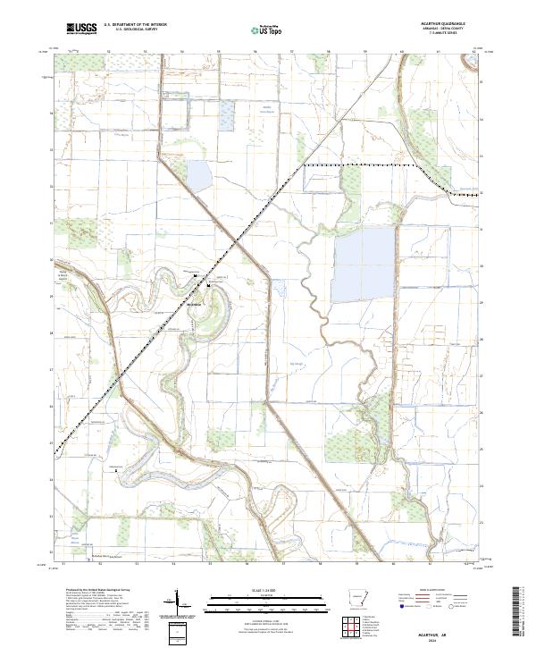
2024 Map of McArthur
USGS Topo · Published 2024About this map
McArthur sits at the heart of this Desha County landscape, where the agricultural patterns of the Arkansas Delta meet a complex network of waterways. The terrain is defined by the winding paths of Coon Bayou, Boggy Bayou, and the Little Bayou Macon, supplemented by engineered drainage like Canal Number 16 and Canal Number 43. This contemporary survey reveals a rural economy supported by local aviation, including the McGehee Municipal Airport and the private Flying G Ranch Airport. For those tracing local families, the map anchors the community through several burial sites, such as McArthur Cem, Warrington Cem, and Palestine Cem. The presence of the Great River Rd cutting through the center highlights the area's role in the broader regional transportation corridor along the Mississippi alluvial plain.
Find a feature on this map
42 named features on this map. Tap any name to fly to it.
Don’t see what you’re looking for? This feature index may not catch every label — zoom into the map to look around manually.
Map Details
Editions of this 2024 McArthur Map
This is the sole edition of this map. No revisions or reprints were ever made.
Other maps of this area

1933 · Lamont
USGS Topo · 1:62,500

1935 · Red Fork
USGS Topo · 1:62,500

1936 · McGehee
USGS Topo · 1:62,500

1937 · McGehee
USGS Topo · 1:62,500

1939 · Big Island
USGS Topo · 1:62,500

1939 · Lamont
USGS Topo · 1:62,500

1953 · Greenwood
USGS Topo · 1:250,000

1955 · McGehee
USGS Topo · 1:62,500

1956 · Greenwood
USGS Topo · 1:250,000
1969 · Winchester
USGS Topo · 1:24,000