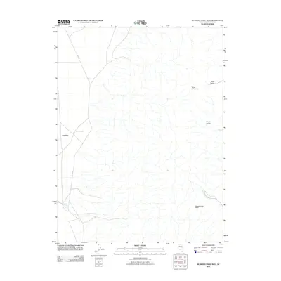
2012 Map of McBrides Sheep Well
USGS Topo · Published 2012About this map
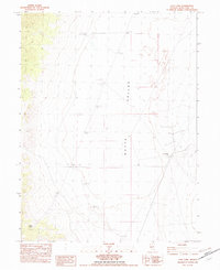
Long Valley dominates the western portion of this high-desert Nevada landscape, where water sources were critical for the livestock operations of the early 21st century. The map centers on isolated outposts like McBrides Sheep Well and Dry Lake Well, small but essential landmarks for local ranching history. To the east, the terrain rises sharply into the Butte Mountains, which are dissected by drainage systems including North Canyon and Middle Canyon. These canyons feed into the lower basins via seasonal watercourses such as White Sage Wash and Swasey Knolls Wash. The presence of Co RD-3 provides the primary transit route through this open range, connecting the remote valley floor to the rugged high ground, reflecting a classic Great Basin settlement pattern where life is structured around sparse water points.
Find a feature on this map
9 named features on this map. Tap any name to fly to it.
Don’t see what you’re looking for? This feature index may not catch every label — zoom into the map to look around manually.
Map Details
Editions of this 2012 McBrides Sheep Well Map
This is the sole edition of this map. No revisions or reprints were ever made.
Other maps of this area

1956 · Ely
USGS Topo · 1:250,000

1959 · Ely
USGS Topo · 1:250,000

1963 · Ely
USGS Topo · 1:250,000
1982 · Cabin Spring
USGS Topo · 1:24,000

1982 · White Sage Well
USGS Topo · 1:24,000
1982 · McBrides Sheep Well
USGS Topo · 1:24,000
1982 · Long Valley Slough
USGS Topo · 1:24,000
1982 · Cow Camp
USGS Topo · 1:24,000

1982 · Dickenson Well
USGS Topo · 1:24,000

1982 · Sunshine Well
USGS Topo · 1:24,000