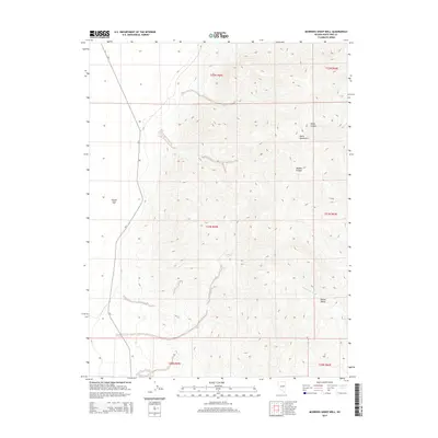
2014 Map of McBrides Sheep Well
USGS Topo · Published 2014About this map
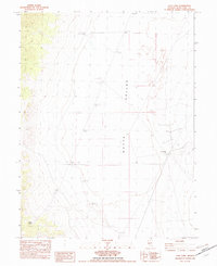
Butte Mountains topography dominates this section of White Pine County, showing the intricate drainage patterns of the Great Basin. This high-elevation desert landscape is defined by its arid valley floors and steep canyons, notably North Canyon and Middle Canyon, which provide essential corridors for runoff during seasonal rains. The presence of McBrides Sheep Well serves as a reminder of the region's long-standing reliance on isolated water sources for livestock and transit. To the southeast, White Sage Wash winds through the floor of Queue Valley, illustrating the intermittent nature of water movement in this terrain. Human infrastructure is sparse, represented primarily by the north-south route of CR-3 and the established public land survey system grid, which includes townships like t21n r59e and t22n r60e.
Find a feature on this map
13 named features on this map. Tap any name to fly to it.
Don’t see what you’re looking for? This feature index may not catch every label — zoom into the map to look around manually.
Map Details
Editions of this 2014 McBrides Sheep Well Map
This is the sole edition of this map. No revisions or reprints were ever made.
Other maps of this area

1956 · Ely
USGS Topo · 1:250,000

1959 · Ely
USGS Topo · 1:250,000

1963 · Ely
USGS Topo · 1:250,000
1982 · Cabin Spring
USGS Topo · 1:24,000

1982 · White Sage Well
USGS Topo · 1:24,000
1982 · McBrides Sheep Well
USGS Topo · 1:24,000
1982 · Long Valley Slough
USGS Topo · 1:24,000
1982 · Cow Camp
USGS Topo · 1:24,000

1982 · Dickenson Well
USGS Topo · 1:24,000

1982 · Sunshine Well
USGS Topo · 1:24,000