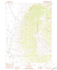
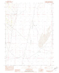
1982 Map of McBrides Sheep Well
USGS Topo · Published 1982About this map
Long Valley stretches across the western portion of this 1982 provisional map, defined by its stark contrast with the towering Butte Mountains that dominate the central and eastern sections. This landscape, as documented by the Geological Survey, shows a sparse but functional network of high-desert infrastructure. The terrain is marked by seasonal drainages labeled as Wash, with water sources like Dry Lake Well providing critical points in an otherwise arid environment. Small-scale industrial activity is evident through the presence of several Borrow Pits and a Gravel Pit along the western edge.
Find a feature on this map
15 named features on this map. Tap any name to fly to it.
Don’t see what you’re looking for? This feature index may not catch every label — zoom into the map to look around manually.
Map Details
Editions of this 1982 McBrides Sheep Well Map
This is the sole edition of this map. No revisions or reprints were ever made.
Other maps of this area

1956 · Ely
USGS Topo · 1:250,000

1959 · Ely
USGS Topo · 1:250,000

1963 · Ely
USGS Topo · 1:250,000
1982 · Cabin Spring
USGS Topo · 1:24,000

1982 · White Sage Well
USGS Topo · 1:24,000
1982 · Long Valley Slough
USGS Topo · 1:24,000
1982 · Cow Camp
USGS Topo · 1:24,000

1982 · Dickenson Well
USGS Topo · 1:24,000

1982 · Sunshine Well
USGS Topo · 1:24,000
1982 · Sunshine Well NW
USGS Topo · 1:24,000