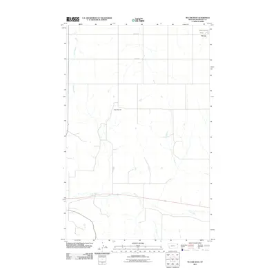
2011 Map of McCabe West
USGS Topo · Published 2011About this map
The settlement of McCabe and the associated McCabe Post Office anchor the northeastern corner of this Roosevelt County landscape. The terrain is defined by the drainage patterns of Sheep Creek and Clover Creek, which carve across the prairie south of Sugar Top Hill. This 2011 survey reflects the intersection of agricultural land use and regional infrastructure, marked by a systematic grid of thoroughfares including McCabe Rd, County Rd, and Sugar Top Rd. The map illustrates how local geography and survey lines dictated the layout of rural Montana settlements and their critical postal links during the early 21st century.
Find a feature on this map
8 named features on this map. Tap any name to fly to it.
Don’t see what you’re looking for? This feature index may not catch every label — zoom into the map to look around manually.
Map Details
Editions of this 2011 McCabe West Map
This is the sole edition of this map. No revisions or reprints were ever made.
Other maps of this area

1914 · Homestead
USGS Topo · 1:62,500

1949 · Johnson Lake
USGS Topo · 1:24,000
1950 · Johnson Lake
USGS Topo · 1:24,000

1954 · Wolf Point
USGS Topo · 1:250,000

1958 · Wolf Point
USGS Topo · 1:250,000

1969 · Cedar Coulee
USGS Topo · 1:24,000
1969 · Culbertson
USGS Topo · 1:24,000

1969 · Three Buttes
USGS Topo · 1:24,000

1969 · Dugout Creek
USGS Topo · 1:24,000

1982 · Culbertson
USGS Topo · 1:100,000