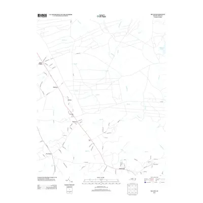
2013 Map of McCain
USGS Topo · Published 2013About this map
McCain and Montrose sit at the center of this rural landscape, which is defined by a dense network of secondary roads and small settlements. The area shows a transition from the higher ground of Sandstone Hill toward the many watercourses feeding the region, including Rockfish Cr and Cabin Br. The presence of Pooles Siding and Railroad Ln suggests the legacy of rail infrastructure that historically supported local transport and trade. To the north, Ashley Heights and Ashmont cluster along the main thoroughfares, while the southern portion of the quadrangle is marked by the crossroad community of Timberland. Aviation history is represented by Viking Airport in the southeast, situated near Mill Cr. The map reveals a land characterized by numerous named branches, such as Gum Br and Field Br, which carve through the terrain between established homesteads and local roads like Old Pinehurst Rd.
Find a feature on this map
85 named features on this map. Tap any name to fly to it.
Don’t see what you’re looking for? This feature index may not catch every label — zoom into the map to look around manually.
Map Details
Editions of this 2013 McCain Map
This is the sole edition of this map. No revisions or reprints were ever made.
Other maps of this area

1948 · Southern Pines
USGS Topo · 1:62,500

1948 · Clifdale
USGS Topo · 1:62,500

1948 · Pinebluff
USGS Topo · 1:24,000

1948 · Nicholson Creek
USGS Topo · 1:24,000

1948 · Mc Cain
USGS Topo · 1:24,000

1949 · Wagram
USGS Topo · 1:24,000

1949 · Silver Hill
USGS Topo · 1:24,000

1949 · Laurinburg
USGS Topo · 1:62,500

1950 · Sanatorium
USGS Topo · 1:24,000

1950 · Lobelia
USGS Topo · 1:24,000