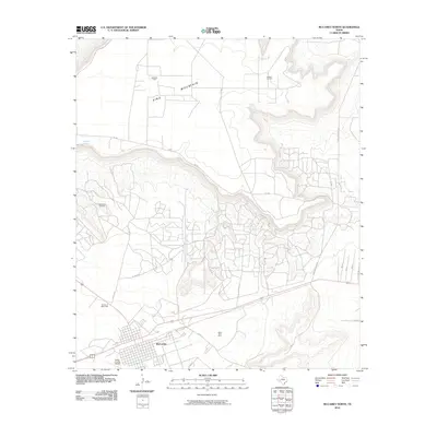
2010 Map of McCamey North
USGS Topo · Published 2010About this map
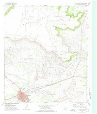
The town of McCamey serves as the focal point of this West Texas landscape, positioned at the base of the massive King Mountain escarpment. The area's mid-century industrial identity is defined by a dense concentration of petroleum infrastructure, including the McCamey Oil Field, Shirk Oil Field, and Fradean Oil Field. Significant land use patterns are evident in the sprawling Mesa Tank Farm and the transportation hub at Upton County Airport. Beyond the industrial footprint, the map records essential water sources in this arid environment, such as Old Maid Spring and Barrel Spring, along with the local Garden of Memories cemetery. The layout of Co Rd 410 and Shell Rd reflects a network of access roads dictated by the topography of the mesa and the requirements of the surrounding oil fields.
Find a feature on this map
23 named features on this map. Tap any name to fly to it.
Don’t see what you’re looking for? This feature index may not catch every label — zoom into the map to look around manually.
Map Details
Editions of this 2010 McCamey North Map
This is the sole edition of this map. No revisions or reprints were ever made.
Other maps of this area

1928 · Crane
USGS Topo · 1:125,000

1954 · Pecos
USGS Topo · 1:250,000

1957 · Pecos
USGS Topo · 1:250,000
1971 · Marlboro Canyon SE
USGS Topo · 1:24,000

1971 · Marlboro Canyon
USGS Topo · 1:24,000

1972 · Girvin NE
USGS Topo · 1:24,000
1972 · McCamey South
USGS Topo · 1:24,000
1972 · Table Top Mountain
USGS Topo · 1:24,000
1972 · McCamey North
USGS Topo · 1:24,000
1972 · Girvin SE
USGS Topo · 1:24,000