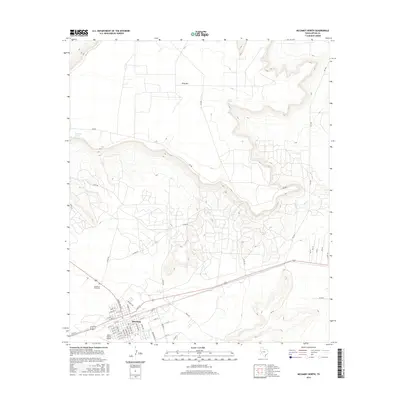
2016 Map of McCamey North
USGS Topo · Published 2016About this map
McCamey sits at the southern edge of this West Texas landscape, where the flat Permian Basin floor meets the dramatic rising slopes of King Mtn. The town’s orderly street grid, including N Burleson Ave and Monroe Ave, reflects its history as a center for the regional petroleum and aviation industries, supported by the Upton County Airport. To the north and east, the terrain becomes increasingly complex as the mesa edge of King Mtn breaks into a series of canyons and draws. Natural water sources like Old Maid Spring and Barrel Spring provide critical landmarks in this arid environment, while the Garden of Memories cemetery serves as a focal point for local genealogy. The network of county roads, such as Co RD 410 and RD 480, highlights the reach of rural development across the mesa and into the surrounding plains.
Find a feature on this map
55 named features on this map. Tap any name to fly to it.
Don’t see what you’re looking for? This feature index may not catch every label — zoom into the map to look around manually.
Map Details
Editions of this 2016 McCamey North Map
This is the sole edition of this map. No revisions or reprints were ever made.
Other maps of this area

1928 · Crane
USGS Topo · 1:125,000

1954 · Pecos
USGS Topo · 1:250,000

1957 · Pecos
USGS Topo · 1:250,000
1971 · Marlboro Canyon SE
USGS Topo · 1:24,000

1971 · Marlboro Canyon
USGS Topo · 1:24,000

1972 · Girvin NE
USGS Topo · 1:24,000
1972 · McCamey South
USGS Topo · 1:24,000
1972 · Table Top Mountain
USGS Topo · 1:24,000
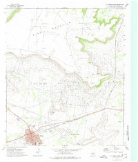
1972 · McCamey North
USGS Topo · 1:24,000
1972 · Girvin SE
USGS Topo · 1:24,000