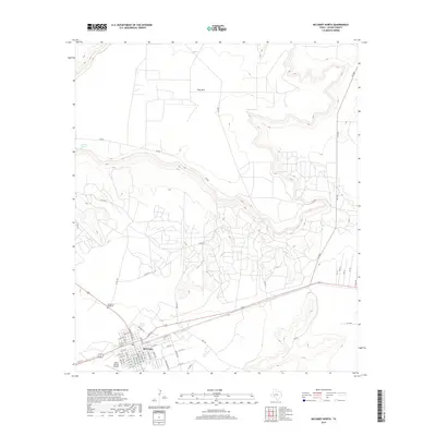
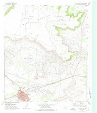
2019 Map of McCamey North
USGS Topo · Published 2019About this map
McCamey sits at the southwestern edge of the Edwards Plateau, where the town's street grid, including N Burleson Ave and W Patton St, meets the aviation infrastructure of the Upton County Airport. This landscape is defined by the dramatic escarpment of King Mtn, which dominates the northern horizon above the town. The transition from the flat plains to the high mesas is marked by several natural water sources such as Old Maid Spring and Barrel Spring, which were vital markers in this arid environment long before the establishment of modern roads. A network of ranch roads and county routes, including Shell Rd and FM 2463, fan out from the settlement into the high country. For genealogists and local historians, the Garden of Memories cemetery serves as a significant record of the community's residence in this corner of Upton County.
Find a feature on this map
57 named features on this map. Tap any name to fly to it.
Don’t see what you’re looking for? This feature index may not catch every label — zoom into the map to look around manually.
Map Details
Editions of this 2019 McCamey North Map
This is the sole edition of this map. No revisions or reprints were ever made.
Other maps of this area

1928 · Crane
USGS Topo · 1:125,000

1954 · Pecos
USGS Topo · 1:250,000

1957 · Pecos
USGS Topo · 1:250,000
1971 · Marlboro Canyon SE
USGS Topo · 1:24,000

1971 · Marlboro Canyon
USGS Topo · 1:24,000

1972 · Girvin NE
USGS Topo · 1:24,000
1972 · McCamey South
USGS Topo · 1:24,000
1972 · Table Top Mountain
USGS Topo · 1:24,000
1972 · McCamey North
USGS Topo · 1:24,000
1972 · Girvin SE
USGS Topo · 1:24,000