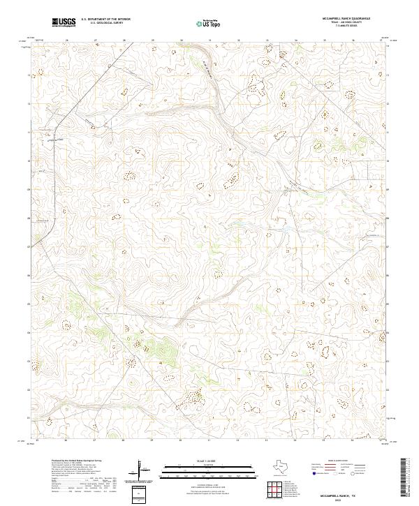
2022 Map of McCampbell Ranch
USGS Topo · Published 2022About this map
Ephemeral watercourses like Arroyo de Magueyes and Arroyo del Gato define the drainage of this South Texas ranchland. The landscape is characterized by its wide, open spaces and the subtle relief of the Rio Grande Plain, where seasonal arroyos have carved shallow paths across the terrain. Human presence is marked primarily by an established network of private ranch roads and lanes, including Cabrito Ln and Wied Rd. This modern survey by the U.S. Geological Survey shows how the traditional cattle ranching economy remains the primary land use, with family-named landmarks such as Barnhart Rd and Las Vivoritas Ln anchoring the geography. Local connectivity is maintained by FM 1017, which skirts the northeastern portion of the area, providing a link between the isolated ranch headquarters and larger regional hubs.
Find a feature on this map
9 named features on this map. Tap any name to fly to it.
Don’t see what you’re looking for? This feature index may not catch every label — zoom into the map to look around manually.
Map Details
Editions of this 2022 McCampbell Ranch Map
This is the sole edition of this map. No revisions or reprints were ever made.
Other maps of this area

1939 · Bruni
USGS Topo · 1:62,500

1939 · Randado
USGS Topo · 1:62,500

1940 · Randado
USGS Topo · 1:62,500

1956 · Laredo
USGS Topo · 1:250,000

1967 · Hebbronville SE
USGS Topo · 1:24,000

1967 · Hebbronville
USGS Topo · 1:24,000

1972 · Armstrong Ranch
USGS Topo · 1:24,000
1972 · San Pablo Ranch
USGS Topo · 1:24,000

1972 · Bruni SE
USGS Topo · 1:24,000
1972 · Alta Vista Ranch SW
USGS Topo · 1:24,000