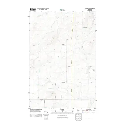
2013 Map of McCarthy Creek
USGS Topo · Published 2013About this map
W Br Knife River and its numerous tributaries, including McCarthy Cr and Captain Jacobson Cr, define the drainage patterns across this section of northeastern Minnesota. The landscape is marked by a network of rural roads often named for local families or landmarks, such as Mikkenen Rd, Laine Rd, and Nappa Rd. A notable high point in the southwestern quadrant is home to the Molde Lookout Tower, a site traditionally used for fire observation in these wooded regions. Further east, the Richard B Helgeson Airport provides a modern aviation footprint amidst the winding paths of the Knife River and Little Knife River. The map also captures the political boundary between St Louis Co and Lake Co, illustrating how administrative lines intersect with the natural flow of streams like Stanley Cr and S Br Mud Cr.
Find a feature on this map
31 named features on this map. Tap any name to fly to it.
Don’t see what you’re looking for? This feature index may not catch every label — zoom into the map to look around manually.
Map Details
Editions of this 2013 McCarthy Creek Map
This is the sole edition of this map. No revisions or reprints were ever made.
Other maps of this area

1953 · French River
USGS Topo · 1:24,000

1953 · Knife River
USGS Topo · 1:24,000

1953 · Ashland
USGS Topo · 1:250,000

1954 · Barrs Lake
USGS Topo · 1:24,000

1954 · Mc Carthy Creek
USGS Topo · 1:24,000

1954 · Two Harbors
USGS Topo · 1:250,000

1956 · Pequaywan Lake
USGS Topo · 1:24,000

1956 · King Lake
USGS Topo · 1:24,000

1957 · Two Harbors
USGS Topo · 1:250,000

1957 · Two Harbors
USGS Topo · 1:62,500