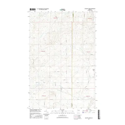
2016 Map of McCarthy Creek
USGS Topo · Published 2016About this map
The W Br Knife River and its numerous tributaries, including McCarthy Cr, Little Knife River, and Captain Jacobson Cr, define the drainage patterns of this northeastern Minnesota landscape. This 2016 survey shows the transition from the upland woods of the St. Louis and Lake County border toward the developing rural residential and transport infrastructure. The eastern portion of the map is dominated by the course of the Knife River, which gathers waters from S Br Mud Cr before flowing south. Cultural landmarks such as the Richard B Helgeson Airport sit alongside a network of township and county routes like Rossini Rd, Fox Farm Rd, and Maki Rd, reflecting the modern rural layout of Alden Township. The map provides a precise look at property divisions and local landmarks like Stanley Cr and the winding Co Hwy 41 corridor.
Find a feature on this map
45 named features on this map. Tap any name to fly to it.
Don’t see what you’re looking for? This feature index may not catch every label — zoom into the map to look around manually.
Map Details
Editions of this 2016 McCarthy Creek Map
This is the sole edition of this map. No revisions or reprints were ever made.
Other maps of this area

1953 · French River
USGS Topo · 1:24,000

1953 · Knife River
USGS Topo · 1:24,000

1953 · Ashland
USGS Topo · 1:250,000

1954 · Barrs Lake
USGS Topo · 1:24,000

1954 · Mc Carthy Creek
USGS Topo · 1:24,000

1954 · Two Harbors
USGS Topo · 1:250,000

1956 · Pequaywan Lake
USGS Topo · 1:24,000

1956 · King Lake
USGS Topo · 1:24,000

1957 · Two Harbors
USGS Topo · 1:250,000

1957 · Two Harbors
USGS Topo · 1:62,500