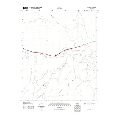
2010 Map of McCartys
USGS Topo · Published 2010About this map
Rio San Jose cuts through this high desert corridor, anchoring a network of roads and settlements that define life along the valley floor. The community of McCartys serves as a focal point, supported by the McCartys Siding and a series of Indian Service Routes that branch out into the surrounding mesa country. To the north, the Basalt Quarry and Chief Rancho indicate the local industrial and ranching presence, while the terrain is marked by significant formations like McCarty Mesa and Horace Mesa.
Find a feature on this map
38 named features on this map. Tap any name to fly to it.
Don’t see what you’re looking for? This feature index may not catch every label — zoom into the map to look around manually.
Map Details
Editions of this 2010 McCartys Map
This is the sole edition of this map. No revisions or reprints were ever made.
Other maps of this area

1883 · Mt. Taylor
USGS Topo · 1:250,000

1886 · Mt. Taylor
USGS Topo · 1:250,000

1892 · Mt. Taylor
USGS Topo · 1:250,000

1899 · Mt. Taylor
USGS Topo · 1:250,000

1917 · Broom Mountain
USGS Topo · 1:125,000

1954 · Socorro
USGS Topo · 1:250,000

1957 · Lobo Springs
USGS Topo · 1:24,000

1957 · Mount Taylor
USGS Topo · 1:24,000

1957 · Grants SE
USGS Topo · 1:24,000

1957 · Mc Cartys
USGS Topo · 1:24,000