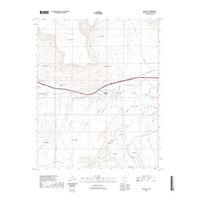
2020 Map of McCartys
USGS Topo · Published 2020About this map
The high plateau landscape of western New Mexico is defined by the prominent Horace Mesa and McCarty Mesa, which overlook the valley of the Rio San Jose. This region, documented in 2020, reveals a settlement pattern focused along the historic transportation corridor of Hst Rte 66. The villages of McCartys Village and Anzac Village represent established communities with complex local road networks such as Pueblo Rd and Stockyard Rd.
Find a feature on this map
52 named features on this map. Tap any name to fly to it.
Don’t see what you’re looking for? This feature index may not catch every label — zoom into the map to look around manually.
Map Details
Editions of this 2020 McCartys Map
This is the sole edition of this map. No revisions or reprints were ever made.
Other maps of this area

1883 · Mt. Taylor
USGS Topo · 1:250,000

1886 · Mt. Taylor
USGS Topo · 1:250,000

1892 · Mt. Taylor
USGS Topo · 1:250,000

1899 · Mt. Taylor
USGS Topo · 1:250,000

1917 · Broom Mountain
USGS Topo · 1:125,000

1954 · Socorro
USGS Topo · 1:250,000

1957 · Lobo Springs
USGS Topo · 1:24,000

1957 · Mount Taylor
USGS Topo · 1:24,000

1957 · Grants SE
USGS Topo · 1:24,000

1957 · Mc Cartys
USGS Topo · 1:24,000