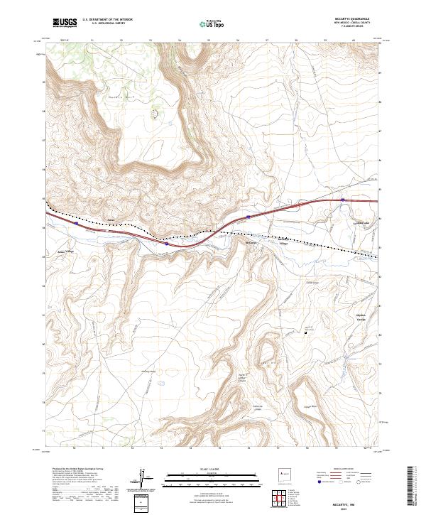
2023 Map of McCartys
USGS Topo · Published 2023About this map
McCartys Village and the nearby Anzac Village sit within a landscape defined by the drainage of the Rio San Jose and the massive plateaus of Horace Mesa and McCarty Mesa. This area of Cibola County is characterized by significant topographic relief, where the water from Acomita Lake and several springs, including Conejo Spring and Canipa Spring, support a network of small settlements and transportation corridors. The historical HST Rte 66 and contemporary interstate infrastructure navigate these mesas, following the natural paths carved by features like Tafoya Canyon and Cañon Largo. For genealogists and local historians, the map provides precise locations for the Mount of Peace Cem and the residential layout of Skyline-Ganipa, offering a modern perspective on traditional land use and habitation patterns in this part of New Mexico.
Find a feature on this map
55 named features on this map. Tap any name to fly to it.
Don’t see what you’re looking for? This feature index may not catch every label — zoom into the map to look around manually.
Map Details
Editions of this 2023 McCartys Map
This is the sole edition of this map. No revisions or reprints were ever made.
Other maps of this area

1883 · Mt. Taylor
USGS Topo · 1:250,000

1886 · Mt. Taylor
USGS Topo · 1:250,000

1892 · Mt. Taylor
USGS Topo · 1:250,000

1899 · Mt. Taylor
USGS Topo · 1:250,000

1917 · Broom Mountain
USGS Topo · 1:125,000

1954 · Socorro
USGS Topo · 1:250,000

1957 · Lobo Springs
USGS Topo · 1:24,000

1957 · Mount Taylor
USGS Topo · 1:24,000

1957 · Grants SE
USGS Topo · 1:24,000

1957 · Mc Cartys
USGS Topo · 1:24,000