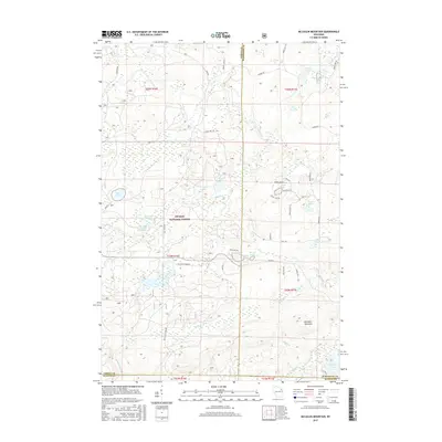
2015 Map of McCaslin Mountain
USGS Topo · Published 2015About this map
McCaslin Mountain dominates this portion of the Nicolet National Forest, where the intersection of Forest, Marinette, and Oconto counties forms a complex boundary within the Wisconsin Northwoods. The landscape is defined by its glacial hydrology, featuring a dense network of water bodies including Crane Lake, Berry Lake, and Evergreen Lake. The drainage patterns are visible through the course of the Rat River and Pemebonwon River, while the Deer Lake Flowage and Deer Lake Outlet Flowage indicate managed water levels in the western section. Access to this densely wooded interior is provided by a grid of specialized forest routes such as McCaslin Tower Rd, Valley Lake Rd, and Camp 7 Rd, supporting both conservation and timber management. This 2015 survey reflects a wilderness preserved for recreation and forestry, centered on the prominent ridge of the mountain itself.
Find a feature on this map
58 named features on this map. Tap any name to fly to it.
Don’t see what you’re looking for? This feature index may not catch every label — zoom into the map to look around manually.
Map Details
Editions of this 2015 McCaslin Mountain Map
This is the sole edition of this map. No revisions or reprints were ever made.
Other maps of this area

1939 · Goodman
USGS Topo · 1:48,000

1939 · Laona
USGS Topo · 1:48,000

1940 · Thunder Mtn.
USGS Topo · 1:48,000

1942 · Wabeno
USGS Topo · 1:48,000

1946 · Laona
USGS Topo · 1:48,000

1946 · Goodman
USGS Topo · 1:48,000

1950 · Wabeno
USGS Topo · 1:48,000

1951 · Wabeno
USGS Topo · 1:48,000

1951 · Thunder Mountain
USGS Topo · 1:48,000

1954 · Iron Mountain
USGS Topo · 1:250,000