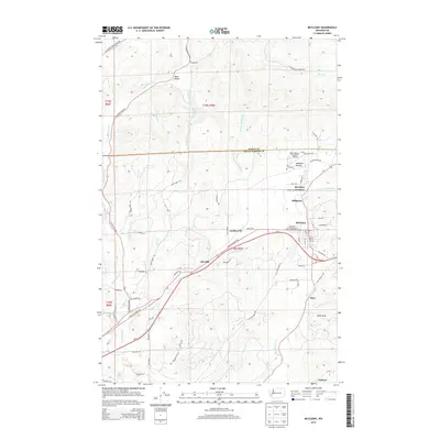
2014 Map of McCleary
USGS Topo · Published 2014About this map
McCleary serves as the central hub of this area where the Black Hills meet the valley floor, located along the Wa-8 corridor in southeastern Grays Harbor County. The landscape is defined by the drainage systems of Cloquallum Cr, Mox Chehalis Cr, and W Fork Wildcat Cr, which carved the terrain long before modern development. Small communities and named locales such as Garden City, Rayville, and Malone dot the southern half of the map, connected by a network of timber and access roads including the Elma McCleary Rd and Old Sand Creek Rd. Genealogists may find interest in the McCleary Pythian Cem or the specific street grids of the town, while the northern reaches transitions into more isolated territory like Dear Valley and the area around Stump Lake. The presence of the Bear Valley Skyranch Airport and several prairie openings like Mohners Prairie reflect the region's mix of aviation, forestry, and rural residential life.
Find a feature on this map
77 named features on this map. Tap any name to fly to it.
Don’t see what you’re looking for? This feature index may not catch every label — zoom into the map to look around manually.
Map Details
Editions of this 2014 McCleary Map
This is the sole edition of this map. No revisions or reprints were ever made.
Other maps of this area

1939 · Shelton
USGS Topo · 1:62,500

1941 · Gate
USGS Topo · 1:62,500

1941 · Ford
USGS Topo · 1:62,500

1943 · Nahwatzel Lake
USGS Topo · 1:62,500

1953 · Hoquiam
USGS Topo · 1:250,000

1953 · Rochester
USGS Topo · 1:62,500

1953 · Malone
USGS Topo · 1:62,500

1953 · Shelton
USGS Topo · 1:62,500

1953 · Elma
USGS Topo · 1:62,500

1957 · Hoquiam
USGS Topo · 1:250,000