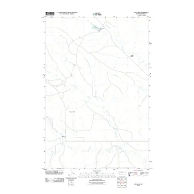
2011 Map of McCloud
USGS Topo · Published 2011About this map
McCloud is the central point of this Prairie County landscape, where the prairie is defined by a dense network of seasonal drainages and local topography. The geography is shaped by the winding courses of Plenty Creek and Cherry Creek, while more prominent elevations like Bowgun Butte rise above the surrounding flats. To the north, the Homestead Reservoir and Homestead Dam represent the essential management of water in this semi-arid environment, collecting runoff from Cedar Creek. Transportation through this corner of Montana is facilitated by Fas 253 and Bowgun Rd, which connect the small settlement to the broader region. The map reveals a land structured by its coulees and creek forks, such as Smith Coulee and North Fork Plenty Creek, illustrating the intersection of ranching infrastructure and natural watercourses.
Find a feature on this map
13 named features on this map. Tap any name to fly to it.
Don’t see what you’re looking for? This feature index may not catch every label — zoom into the map to look around manually.
Map Details
Editions of this 2011 McCloud Map
This is the sole edition of this map. No revisions or reprints were ever made.
Other maps of this area

1953 · Miles City
USGS Topo · 1:250,000

1954 · Glendive
USGS Topo · 1:250,000

1957 · Miles City
USGS Topo · 1:250,000

1957 · Glendive
USGS Topo · 1:250,000

1958 · Miles City
USGS Topo · 1:250,000

1958 · Glendive
USGS Topo · 1:250,000

1972 · Calypso
USGS Topo · 1:24,000

1972 · Papps Reservoir
USGS Topo · 1:24,000

1972 · Mc Clure Reservoir
USGS Topo · 1:24,000

1972 · Mc Cloud
USGS Topo · 1:24,000