2020 Map of McCloud
USGS Topo · Published 2020About this map
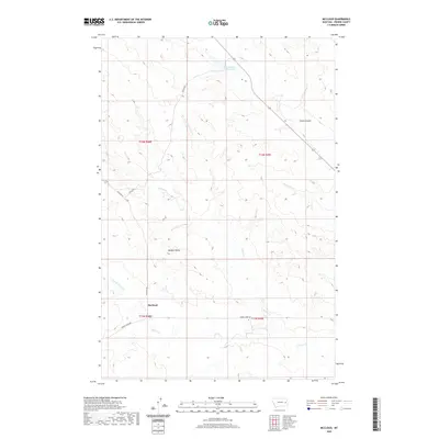
McCloud and its surrounding prairie landscapes are defined by an intricate network of drainages and local landmarks in this modern survey. The terrain is shaped by the presence of Plenty Cr and its northern fork, alongside Cherry Cr and its own northern tributary, illustrating the complex hydrology of this part of Montana. Named landmarks like Bowgun Butte and Smith Coulee provide vertical relief and local orientation within the township system. Settlement patterns are sparse, represented by the eponymous McCloud and rural infrastructure such as Homestead Reservoir to the north. Transportation is limited to a few arterial paths like Cherry Creek Rd and Bowgun Rd, which follow the contours of the land and the paths of the local creeks, characteristic of the region’s ranching and agricultural layout.
Find a feature on this map
17 named features on this map. Tap any name to fly to it.
Don’t see what you’re looking for? This feature index may not catch every label — zoom into the map to look around manually.
Map Details
Editions of this 2020 McCloud Map
This is the sole edition of this map. No revisions or reprints were ever made.
Other maps of this area

1953 · Miles City
USGS Topo · 1:250,000

1954 · Glendive
USGS Topo · 1:250,000

1957 · Miles City
USGS Topo · 1:250,000

1957 · Glendive
USGS Topo · 1:250,000

1958 · Miles City
USGS Topo · 1:250,000

1958 · Glendive
USGS Topo · 1:250,000

1972 · Calypso
USGS Topo · 1:24,000

1972 · Papps Reservoir
USGS Topo · 1:24,000

1972 · Mc Clure Reservoir
USGS Topo · 1:24,000

1972 · Mc Cloud
USGS Topo · 1:24,000