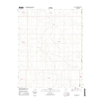
2017 Map of McCloy Ranch
USGS Topo · Published 2017About this map
McCloy Ranch serves as the primary landmark in this section of the High Plains, situated within a landscape defined by its ranching history and local transport network. The map reveals the intersection of several county routes, most notably the winding path of Highwell Rd as it moves across the central terrain. This area sits at a significant political junction where the boundaries of Union, Harding, and Quay counties meet, illustrating the administrative divisions of the eastern New Mexico grasslands. The road network, including Co Rd G and Co Rd I-1, suggests a rural infrastructure built around the needs of large landholdings and livestock movement in a region where water and topography dictate the placement of local homesteads and access roads.
Find a feature on this map
15 named features on this map. Tap any name to fly to it.
Don’t see what you’re looking for? This feature index may not catch every label — zoom into the map to look around manually.
Map Details
Editions of this 2017 McCloy Ranch Map
This is the sole edition of this map. No revisions or reprints were ever made.
Other maps of this area

1954 · Tucumcari
USGS Topo · 1:250,000

1958 · Tucumcari
USGS Topo · 1:250,000

1966 · Rosebud
USGS Topo · 1:24,000

1966 · Ione
USGS Topo · 1:24,000

1966 · Cherokee Valley
USGS Topo · 1:24,000

1966 · Lockney
USGS Topo · 1:24,000

1966 · Mc Carty Ranch
USGS Topo · 1:24,000

1966 · Mc Cloy Ranch
USGS Topo · 1:24,000

1969 · Gallegos NE
USGS Topo · 1:24,000
1969 · Fuentes Ranch
USGS Topo · 1:24,000