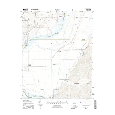
2015 Map of McClure
USGS Topo · Published 2015About this map
The Mississippi River serves as the grand divide in this 2015 study, carving a path between the steep terrain of Missouri and the flat bottomlands of Illinois. The map captures the sharp contrast between the wooded ridges of the Shawnee National Forest in Illinois and the elevated limestone bluffs like Cape Rock across the water. On the eastern shore, the settlement of McClure sits at the base of these ridges, while East Cape Girardeau occupies the low-lying river bend near Edmondson Slough.
Find a feature on this map
63 named features on this map. Tap any name to fly to it.
Don’t see what you’re looking for? This feature index may not catch every label — zoom into the map to look around manually.
Map Details
Editions of this 2015 McClure Map
This is the sole edition of this map. No revisions or reprints were ever made.
Other maps of this area

1920 · Jonesboro
USGS Topo · 1:62,500

1922 · Cape Girardeau
USGS Topo · 1:62,500

1923 · Jonesboro
USGS Topo · 1:62,500

1924 · Cape Girardeau
USGS Topo · 1:62,500

1934 · Thebes
USGS Topo · 1:62,500

1934 · Morley
USGS Topo · 1:62,500

1939 · Morley
USGS Topo · 1:62,500

1939 · Thebes
USGS Topo · 1:62,500

1947 · Jonesboro
USGS Topo · 1:62,500

1947 · Mc Clure
USGS Topo · 1:24,000