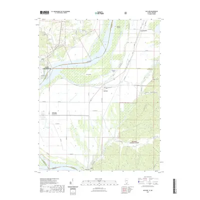
2021 Map of McClure
USGS Topo · Published 2021About this map
The Mississippi River acts as a major geographical divider here, separating the city of Cape Girardeau, Missouri, from the low-lying bottomlands of Illinois. This riverine environment is defined by large landforms within the channel, including Devils Island, Picayune Island, and the Swiftsure Towhead. On the Illinois side, a network of levees and drainage ditches supports small agricultural communities such as McClure, East Cape Girardeau, and Gale. The landscape transitions abruptly from the flat floodplains to the timbered bluffs of the Shawnee National Forest in the east.
Find a feature on this map
106 named features on this map. Tap any name to fly to it.
Don’t see what you’re looking for? This feature index may not catch every label — zoom into the map to look around manually.
Map Details
Editions of this 2021 McClure Map
This is the sole edition of this map. No revisions or reprints were ever made.
Other maps of this area

1920 · Jonesboro
USGS Topo · 1:62,500

1922 · Cape Girardeau
USGS Topo · 1:62,500

1923 · Jonesboro
USGS Topo · 1:62,500

1924 · Cape Girardeau
USGS Topo · 1:62,500

1934 · Thebes
USGS Topo · 1:62,500

1934 · Morley
USGS Topo · 1:62,500

1939 · Morley
USGS Topo · 1:62,500

1939 · Thebes
USGS Topo · 1:62,500

1947 · Jonesboro
USGS Topo · 1:62,500

1947 · Mc Clure
USGS Topo · 1:24,000